[UPDATE 2025-03-03] This is an historical article. To see what scheme we proposed, please read this post: https://betterstreetshq.com/2025/03/03/proposals-for-safer-harborne-streets/
—-
Since sharing our suggested traffic management scheme with the community, councillors, city planners and other stakeholders, we have had an amazing amount of feedback. We received many thoughtful comments, positive support and concerns of any changes to current travel patterns.
To address the wide ranging suggestions for alternative approaches to dealing with traffic in the area, from parking permits to school admissions, we created this document: Harborne East traffic management – FAQ: https://betterstreetshq.com/2024/11/22/harborne-east-traffic-management-faq/
In consideration of the feedback received, we are reviewing our schemes and presenting revised recommendations.
You can view the original schemes in more detail from the presentation first shown in November 2024:
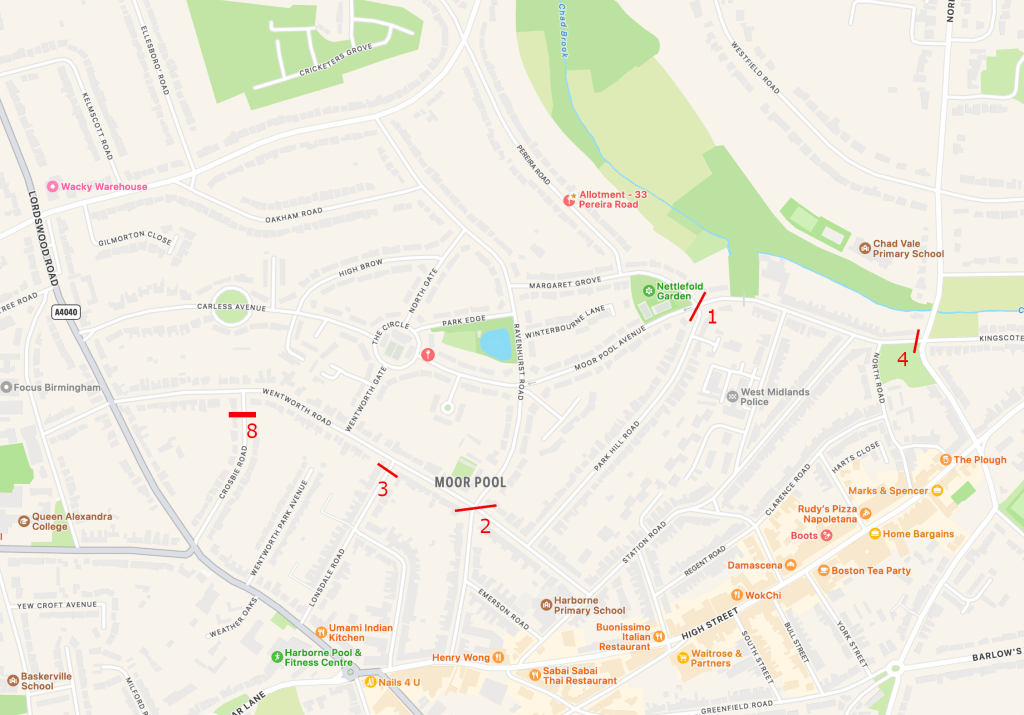
Particular attention was drawn to Park Hill road, around a concern that Scheme B would redirect traffic on to what is currently a relatively quiet road.
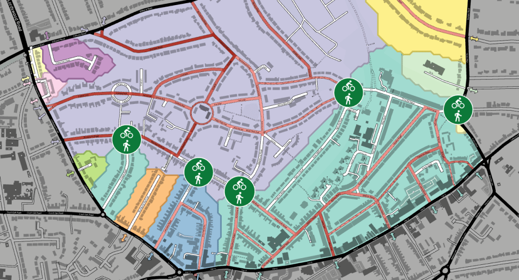
To better explore this concern (and other aspects of potential schemes), we are using software called ABStreet; a modelling software that indicates how a scheme may impact our neighbourhood. This allows us to show how a scheme would create areas which can easily be accessed, but not crossed using a motor vehicle. All areas would remain accessible and safer to people outside of a car.
https://github.com/a-b-street/abstreet
Firstly our existing area, which is mostly one large fully permeable region of ~1.4km2

The darker red a road is coloured, the more available routes use that road, and so the more likely it will be a cut-through (other factors notwithstanding). We know that Ravenhurst Road, Wentworth Road, parts of Park Hill Road are already very busy, and this is reflected in how many routes they can be used in.
Now to review the Scheme B that we previously presented.

We can see a once moderately quiet section of Park Hill Road now becomes a key route for cut-through traffic. This is even with a northbound one-way applied to the road. This is a one-way on a downhill section likely to encourage speeding.
We included Scheme B as an option for a couple of reasons, despite discussing some shortcomings. Firstly, having the filter under the bridge is using an existing choke point, one that has been experienced before during repairs to the bridge, with what many felt were positive results. Secondly, we also understand that many people wanted to see access through the area and this was a compromise to achieve that. However, the residents of Park Hill Road understandably didn’t want their traffic to become like that on Ravenhurst Road. No-one wants to displace that traffic, but if a cut-through route remains that is almost exactly the same as what exists, it will certainly be used.
We now come back to Scheme A – version 2. This is a revision of our original Scheme A but with a key change. We have added a filter to Crosbie Road, there was a risk of cut-through traffic using The Circle and Crosbie Road. Again, we don’t want to see traffic displaced to other residential streets.

This neatly creates regions without cut-through traffic, but still retaining easy access to boundary roads for car traffic.
Though parts of Ravenhurst Road and North Gate may become the most available routes, it’s very unlikely that someone would drive down Ravenhurst Road, through the Circle and back up Wentworth Road to avoid the freer flowing sections of Gillhurst Road and Lordswood Road.
Summary
Receiving feedback from planners and the community has been fantastic. It continually shapes how we view the area from different perspectives and allows us to continually develop better recommendations. Scheme A.v2 takes on many of the key concerns and suggestions raised and aims to enable and activate a neighbourhood that makes people feel safe and empowered to travel outside of a car. We’re sure other revisions will come, but for now we believe this is the best way to achieve the city’s goals.
[Edit 2025-01-20 – Following request for revised plan, see below]